
This project will study roadway improvements and develop alternatives to improve the safety and operation on US 2 through the Bad Rock Canyon area. The Other (OT) Phase study will look at reconstructing the roadway to meet current MDT design standards, provide safety enhancements, and identify potential options for a new multi-use path while minimizing impacts to the environmental, cultural, scenic, and recreational characteristics of the corridor. The project is located in northwestern Montana in Flathead County on US 2 (N-1) between Columbia Heights and Hungry Horse within the Flathead National Forest. The project corridor is bordered by the Flathead River to the north and intermittent rock cliffs to the south. The study begins at Reference Post (RP) 139.8 and extends approximately 1.7 miles east to RP 141.5. If an acceptable alternative is determined, MDT plans to move into a Design Phase to reconstruct this segment which would require right-of-way acquisition and utility relocations.
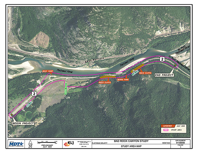
US 2 - Badrock Canyon Corridor Planning Study Area Map PDF (archived*)