
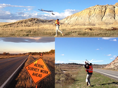
The use of small Unmanned Aerial Vehicles (sUAV) is rapidly growing in the Transportation Industry. Some of the applications where UAVs are being effectively used include:
- Mapping
- Infrastructure Inspection
- Construction Monitoring
- Stockpile and Earthwork Volume Measurements
- Rockfall Site Investigation
- Vegetative Health Assessment
Some state DOTs have begun developing their own UAV programs while others are currently researching the technology. DOTs and other infrastructure owners could greatly benefit from the sharing of knowledge and experiences with one another. A wide range of topics relating to UAV use in the Transportation Industry will be discussed including FAA regulations, technical Q&A, equipment, flight planning, data processing, etc. To this end, MDT has set up a community forum to facilitate these communications. These conversations and other resources will be posted to this website.
Unmanned Aerial Systems Construction Research Project
UAV References
Unmanned Aerial Vehicles Community Forum
If you would like to join the UAV Community Forum, please use the link below. Please note: while this community is open to anyone, the purpose is to share information. There should be no solicitations posted in the community. Also, resources shared through the community will be added to the above linked UAV Resources document.
Join the Community - This link will take you to a page with a Login link in the upper right hand corner. Select the Login link to create an account, and to access the UAV forum.