

What is access management?
Access management is a strategy for managing the type of development along and physical connections to transportation corridors by regulating the frequency or location of access points along roadways. Access points range from interchanges and intersecting streets to driveways and curb cuts. Access points are integral in allowing vehicles, bicyclists, and pedestrians to enter the roadway and reach their destinations. However, access points can increase the risk of crashes among vehicles and other roadway users. They can also lead to bottlenecks and backups at intersections, which reduce travel speeds, roadway capacity, and overall throughput.
Access management addresses the classic dilemma between corridor-wide throughput (or "mobility") and local accessibility. Requirements can include a minimum spacing distance between access points that affects the design and location of new roads and driveways. Less aggressive techniques may be employed to encourage retrofitting old networks to close and consolidate ineffective access points. Access requirements usually address access classification of the roadway, intersection spacing standards, corner clearance, access among properties, driveway spacing and design, and overlay zones.
Access management ordinances help alleviate the conditions caused by unregulated curb cuts and commercial development along major corridors by providing guidelines for traffic signal spacing, location of driveways, median openings, and multimodal options. In the absence of access management, growing corridors can deteriorate functionally and aesthetically, with rising levels of intersection congestion and turning-movement crashes affecting social, economic, physical, and environmental quality.
Typically, access management is achieved gradually as development and redevelopment occurs. Existing commercial driveways, for example, may be "grandfathered" into an access management ordinance, but may have to be moved to an alternate access point when the property is redeveloped or a new access road is constructed.
Who can implement it?
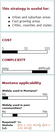
Access management can be initiated at the local level or at the State level. Statewide access management requirements are usually applied to roadways that have statewide or national significance and that are managed by the state DOT. Local access management requirements can be developed and adopted by municipalities for corridors that they build and maintain. Requirements for state routes that are operated and maintained by localities are typically developed through a joint process between the local and state agency. Chapter 8 of the MDT Right of Way manual describes the processes specific to Montana.
In addition to establishing requirements for geometric elements such as driveway spacing, local governments can adopt subdivision regulations and site design standards that support access management, such as local street connectivity and compact urban form. Localities can adopt overlay districts along transportation corridors and integrate access management ordinances into the administration of the existing zoning ordinance.
One access management technique is to increase the minimum lot frontage requirements for properties abutting major transportation routes, and/or to tie the minimum lot frontage to connection spacing standards. For example, Levy County, FL established access spacing requirements for a primary arterial, U.S. Hwy 19. This standard is tied to 660 ft access spacing requirements of Florida DOT. Licking County, OH handles many access issues through a land division process for major and minor land divisions.
Local governments can also establish a requirement that properties which are consolidated for development, or those under common ownership, will be treated as one property for the purposes of access review. Similarly, they can require outparcels to be tied into the on-site circulation system of the larger shopping center. Florida uses this model.
What are the keys to success and potential pitfalls?
Customization: Access management strategies address the conflict between accessibility and mobility. Regulations and guidelines must account for the context and function of the corridor in order to achieve an appropriate balance. Access management standards that promote dense spacing of streets and driveways along the corridor will permit a significant amount of development to occur, though at some cost to mobility along the corridor. On the other hand, restrictive standards that limit street and driveway connections will typically reduce development potential while promoting high-speed travel along the corridor. Access management standards should be customized to promote the appropriate context along transportation corridors.
Coordination: The siting of transportation facilities must be a central component of any successful growth management strategy, as the location and type of transportation facilities will have a direct impact in determining where land development will occur. Because access management can be implemented at both state and local levels, and since roadway access is a critical element for economic development initiatives, coordination between agencies is vital to the success of access management strategies. MPOs and local governments must play a strong role in facilitating coordination to achieve access management objectives in the planning and decision-making processes.
Execution (follow through): Depending on the scale, statewide or local governmental agencies will be instrumental in ensuring success. On the local level, certainly the governmental agency responsible for maintenance of the road must be involved to ensure that construction and maintenance of the road fits the adopted access management guidelines. Also the agencies responsible for development review must be aware of the standards involved. Many times several departments are involved with development review (planning and zoning, neighborhood development, traffic operations, etc.).
Education: For overlay districts, reviewer training is necessary. A well-written ordinance and clear boundaries will simplify compliance. However, implementing any regulatory mechanism is a highly complex undertaking, involving knowledge of state or federal enabling legislation and extensive public involvement.
Where has this strategy been applied?
Examples in Montana
In Montana, access management studies and plans are most often done in conjunction with MDT's highway reconstruction projects or as standalone projects on road segments.
- Huffine Lane Access Management Plan: The City of Bozeman and Gallatin County prepared an access management plan for US Route 191 in August 2007. This report included design specifics such as typical sections of roadway, street standards, spacing requirements, and detailed language on parcels, lanes, signals and sight distance.
- Access Control US 93 N&S Lolo to Missoula: This standalone access management project along US Highway 93 defines specific access locations consistent with proposed guidelines and techniques. The study tailored its recommendations to each segment of the study area based on each segment's individual characteristics.
- US 93 Corridor between Spring Creek Road and Minesinger Trail: This section of "The People's Way" through Pablo incorporated access management principles.
Examples outside of Montana
- The City of Orlando, FL and Scott County, MN have included access management policies into their long-range growth management and transportation plans.
- The States of Colorado, Florida and Maryland have legislation authorizing the state DOTs and local governments to regulate vehicular access along state highways.
- Colorado was the first state to have a system-wide comprehensive access management program.
- Florida's Access Management Act outlines regulation of access to the state highway system. The act also assists in the coordination of land use planning decisions by local governments, by establishing procedures for interaction between state DOT and local officials to successfully integrate access management into local level planning.
- Martin County, FL Roadway Design Ordinance: Access management was integrated into Local Roadway Design Ordinance Number 561. This section addresses access classification of the roadway and intersection spacing standards, corner clearance, access among properties, driveway spacing and design, and overlay zones. This change assures that future transportation improvements will abide by the intended land uses. While encouraging greater access and mobility, Martin County is able to discourage the use of local streets for cut-through traffic as they maintain the overall connectivity of the roadway system.
- Cedar Park, TX US 183 Enhancement Study: The U.S. 183 Enhancement Study, jointly funded by the Cedar Park Community Development Corporation and City Council includes access management as a critical part of the implementation strategy for corridor enhancements.
- Vermont Access Management Program: The Vermont Agency of Transportation (VTrans) Access Management Program outlines an access classification system and standards to ensure consistency in the permitting process. The standards for each category provide VTrans with the parameters necessary to apply consistent permitting conditions based on a uniform classification system of all state highways. VTrans has created a brochure for developers, a permitting flow chart and an access management guidebook, as well as a website to make the access management program easily understood by members of the local community and businesses.
How can I get started?
Regulatory tools, such as access management standards, overlay districts and design standards are typically derived from a local growth policy or state transportation management policy. Initiatives for access management policies can also be included into long-range transportation plans or written as recommendations for thoroughfare plans and community master plans.
Communities that are considering implementing one of these mechanisms should first establish whether or not a plan is desired and required in order to take the next step. Once a plan and corresponding generalized ordinances are in place, localities can begin to consider more specialized ordinances, such as access management ordinances or overlay zones.
Where can I get more information?
- A Guidebook for Including Access Management in Transportation Planning, National Academies Transportation Research Board National Cooperative Highway Research Program (NCRHP) Report 548
- Land Use and Economic Development in Statewide Transportation Planning: This report provides an overview of state DOT activities related to land use planning in six categories: land use / transportation planning; state land use planning capabilities; education/technical assistance; access management; land use controls; and economic development
- Vermont Best Practices for Access Management
- The Transportation Research Board Access Management committee website contains references and a link to the TRB Access Management Manual
- FHWA Access Management
- Oregon DOT
- University of South Florida Center for Urban Transportation Research (CUTR)
- Planning for Transportation in Rural Areas: This article provides approaches and case study profiles for public consultation, environmental review, transit system planning, intelligent transportation systems (ITS) planning, and access management.