
Although the US 2 – Bad Rock Canyon project communication has been quiet, we wanted to share what progress has been made and the current status of our efforts.
As you know, this project will create roadway improvements and develop alternatives to improve the safety and operation on US 2 through the Bad Rock Canyon area.
After collecting and analyzing soil samples two years ago, the project is now currently on hold while an ethnographic study is being conducted. The Montana Department of Transportation is working closely with Confederated Salish and Kootenai Tribes to complete the study. To ensure the Bad Rock Canyon project best addresses area needs and supports valuable cultural resources, the project will remain on hold until the ethnographic study is completed. As the study is completed, MDT and KLJ will resume exploration of alternatives for the canyon. Public involvement will continue to play an important role as the project moves forward.
Questions or comments about the project may be submitted via email to
Study Focus
US 2 - Badrock Canyon Corridor
Click on the image for a larger view
What’s the plan for US 2 through Bad Rock Canyon?
For years, the Montana Department of Transportation has considered how to improve safety and function on US 2 as it narrows entering the Canyon community and serves as the most popular west-side access into Glacier National Park.
A safer road is the goal for both peak season travelers and daily users. Some big improvements have been made moving us closer to the finish line: providing three and four lanes for traffic and business accesses, a new South Fork River bridge over the Flathead River that ferries traffic into Hungry Horse, and roadside safety improvements have been performed to the east of Bad Rock Canyon.
Safety is a priority not just for motorists, but for pedestrians and cyclists in the area as well.
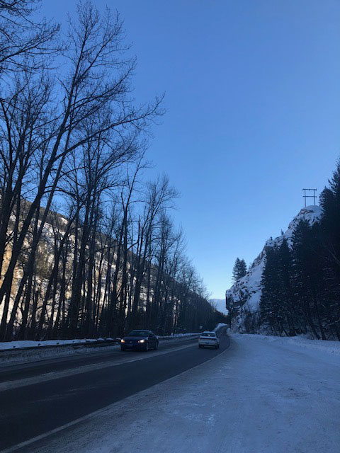
But the section of US 2 from the House of Mystery to the newly-replaced South Fork River bridge still needs work. The narrow canyon is host to many cultural, historical, environmental and scenic resources, which limits the area where the road can be expanded.
Add in a river to the north, and soaring rock cliffs to the south, the real estate for road expansion becomes even more restricted.
The Montana Department of Transportation continues to study what amount of construction can feasibly take place through Bad Rock Canyon.
The study will also explore how long construction take, how to build it while maintaining traffic and, roughly, how much will it cost.
Where is Bad Rock Canyon?
Bad Rock Canyon is located east of Columbia Falls, before US 2 enters Hungry Horse. The area being studied for construction feasibility is about 1.7 miles long.
As the main access road entering Glacier National Park from the west side, US 2 carries about 12,000 – 15,000 cars per day during peak season. With visitor numbers to the Park steadily rising, view park statistics, traffic volumes through Bad Rock Canyon rise as well.
Study Area Map
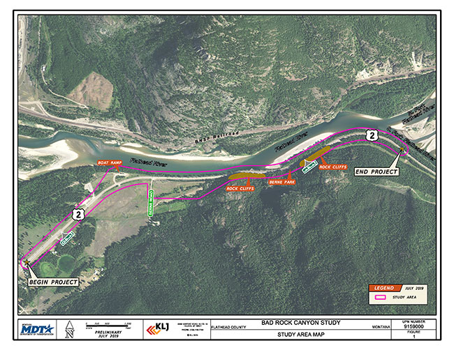
US 2 - Badrock Canyon Corridor Planning Study Area Map PDF (archived*)