

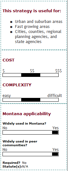
What is secondary data collection?
Secondary data collection tools are used to assemble primary data into systems or datasets that can be used for a variety of planning efforts and analytical tasks. For example, a data gateway provides a "one-stop shop" for multiple data types. A data clearinghouse is an institution or agency that collects and distributes information. A mapping project links data from multiple sources.
Assembled information may include federal, state, and local transportation system data as well as land use, environmental, cultural, historical, and other datasets in spatial or other formats. GIS formats are commonly used to collect and store secondary data. Information is made available to users through a web-based resource or by request.
Who implements secondary data collection?
Many different local, regional, and state agencies, as well as private sector analysts, collect and store secondary data. Implementation requirements vary depending upon the tasks for which the data will be used. Requirements for implementation of comprehensive, multidisciplinary, and/or statewide analyses are greater than those for analyses done at simpler, local scales.
What are the keys to success and potential pitfalls?
Technical Capability: Most secondary data collection initiatives require staff or volunteers who know how to work with GIS and, as needed, other analysis tools, and who have access to high-performance desktop computers. Comprehensive, current, and reliable data is required in specific formats to develop and maintain any system. The complexity will also vary depending on the selected forum for data distribution. For example, a web-based interactive system requires specialized web development and maintenance capabilities.
Data Compatibility: Local, regional, state and federal data providers have worked hard over the past several years to assemble data collected by different agencies into compatible, standardized formats accessible from a single location. This ongoing process reduces the amount of time and resources needed for all users to access the data, and enables the use of analysis tools that require multiple data layers. In addition, the process encourages interagency partnerships.
Where has this strategy been applied?
Examples in Montana
- Montana DOT GIS Database: The MDT GIS database contains a variety of statewide transportation, economic, and behavioral data used to support plans and programs, as well as the public involvement processes associated with these studies. The comprehensive roadway network layer can be combined with other available information, such as travel demand data, to produce GIS-based maps.
- Butte-Silver Bow County GIS: Butte-Silver Bow County developed it GIS system with support from the Atlantic Richfield Company (ARCO) in order to facilitate Superfund cleanup efforts in the community.
- Missoula Online Statistical System (MOSS): The Missoula Office of Planning and Grants developed MOSS, which provides a gateway to demographic information at the county, urban area, and neighborhood (block group) level.
- Montana Cadastral Mapping Project: This program, managed by the Montana Information Technology Services Division, produces and maintains cadastral information in a consistent, digital format for the entire State of Montana based on information from the Montana Department of Revenue Computer Assisted Mass Appraisal System (CAMA) database and the U.S. Bureau of Land Management Geographic Coordinate Database.
- Gallatin County Development Tracking System: Gallatin County uses a layer on their GIS system that shows current subdivisions and the status of projects in the development review process (preliminary plat, approved final plats, etc.). A desired next step for this system is to establish and identify any transportation improvements for which the developer will be held responsible.
Examples outside of Montana
- National Resource Information System: The NRIS housed in United States Forest Service, serves as a clearinghouse and referral service for statewide and regional natural resources information.
- Federal Highway Administration Databases: The FHWA maintains several useful databases for transportation planning and analysis.
- The National Highway Planning Network (NHPN) is a network database of the nation's major highway system.
- The Highway Performance Monitoring System (HPMS) and the National Bridge Inventory (NBI) provide performance data on highways and bridges. The Freight Analysis Framework (FAF) is a policy and systems analysis tool developed to help understand freight demands, assess implications for the surface transportation system, and improve freight efficiency. The FAF database assists users in determining geographic relationships between local trade flows and the Nation's overall transportation system.
- The Highway Safety Information System (HSIS) is an FHWA-sponsored, multistate database containing crash, roadway inventory, and traffic volume data for a select group of States. It includes GIS-based tools for addressing pedestrian and bicycle safety issues.
Case studies
How can I get started?
The first step in secondary data collection is to ascertain which data sources are available and whether it would be more appropriate to collect primary data than to use the secondary data sources. It is also critical to ensure that compatible technology is available to use the information contained in secondary data sources.
Where can I get more information?
- Montana Association of Geographic Information Professionals (MAGIP)
- Using Spatial Data, Tools, and Technologies to Improve Program Delivery TRB Statewide Transportation Data Committee Peer Exchange. Transportation Research E-Circular Number E-CO46, October 2002.
- Montana Geographic Information Clearinghouse