
Final Report
The documents below discuss the findings and recommendations for the Libby North Corridor Study.
- Volume I
- Volume II
- Appendix A
- Appendix B
- Appendix C
- Appendix D
- Appendix E
- Appendix F
- Appendix G
- Appendix H
The Libby Corridor North Study used new SAFETEA-LU rules and regulations to link transportation planning and National Environmental Policy Act Processes. read more...
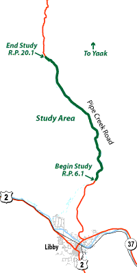
Click Map for Detailed PDF Version
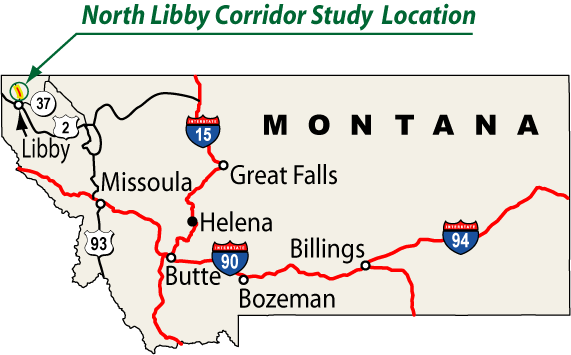
The Montana Department of Transportation initiated this corridor planning study north of Libby to examine the potential needs and issues associated with improving HWY 567/ Pipe Creek Road between mile post 6.1 (BobTail Cutoff Road) and 20.1 (Turner Mountain Rd).
The Corridor Study examined roadway safety, deficiencies, rock fall and other potential geotechnical issues, corridor operations, financial feasibility, environmental issues, and capacity needs. The result of the study is a comprehensive understanding of the needs and issues of improving the road.
The Planning Process involved elected officials, Federal and State agencies, MDT staff, user groups, and land owners. Input was provided by a wide based representation of interested persons and affected parties.
The General Public was given the opportunity to participate throughout the planning process. This was accomplished through the comment form on this website and through participation at two community presentations. The final community presentation was held October 24, 2007.