

What is primary data collection?
Primary data is collected directly from the source. Often collected when the information is not readily available through existing databases, primary data is usually used to measure transportation system performance indicators such as traffic counts, travel times, and ridership data. In addition to manual collection methods, Global Positioning Systems (GPS) software can be used to collect and maintain state and local roadway and transit data.
Who implements primary data collection?
State DOTs work with their internal staff, rural planning organizations, and local jurisdictions to collect and maintain highway and local roadway alignments and attributes.
Roadway and intersection traffic counts are a standard data item for transportation planning studies, traffic impact analysis, and related work. All state DOTs maintain a regular traffic count program for state highways and other major roadways. Traffic counts for minor and local roadways are typically the responsibility of cities and counties, and the regularity of these counts varies by jurisdiction. Intersection turning movement counts tend to also be the responsibility of local jurisdictions or developers that are preparing traffic impact studies.
Any transit operator that receives federal funding must collect and report a host of ongoing statistics regarding equipment, cost, ridership, and unmet demand. As is the case with traffic count data, there is a general lack of procedures for capturing and storing this information for use in subsequent planning and impact analysis activities.
What are the keys to success and potential pitfalls?
Designing and implementing the appropriate primary data collection tool is a key to effective use. There is a wide range in the complexity and technology of available primary data collection tools. Simple, basic methods such as manual traffic counts, surveying, or interviews may be appropriate for small-scale or isolated efforts. As the amount and frequency of data needed increases, the use of automated or web-based data collection tools may be more effective. Although specialized GPS/GIS software can be used to collect local roadway data, it may be more applicable to the needs of a statewide transportation system as the organizational and financial cost may outweigh benefits at the smaller, local scale.
The experience of many jurisdictions is that ample traffic counts are collected over time, particularly for major roadways, but the data systems for assembling, storing, and accessing counts collected by different agencies tend to be weak. By making the effort to synthesize and share data, local and state agencies can get much more effective use out of their various databases, which can pay big dividends when assessing development impacts on local roadways.
Regardless of the scale or complexity of the project, any primary data collection effort should be designed carefully. Selecting the appropriate days, times, and demographic characteristics can be key to conducting an effective data collection effort.
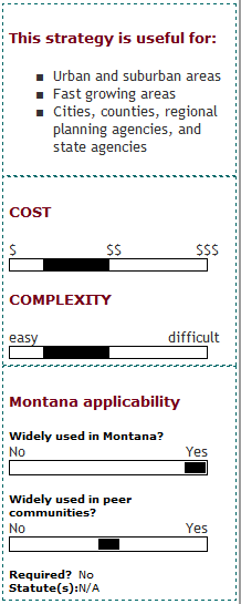
Where has this strategy been applied?
Examples in Montana
- Trimble Global Position System GIS Database: The Trimble GPS for GIS data collection and maintenance is used by several local communities and MDT to map the location of signs and culverts.
Examples outside of Montana
- South Dakota GPS Databases: The South Dakota DOT and South Dakota Planning Districts (Districts) have been using customized GPS software to collect and maintain data on more than 83,000 miles of roadway alignments and their attributes. To maintain the GPS/'GIS program, the South Dakota DOT receives yearly updates from the Planning Districts of roadway changes, additions, or deletions. The Districts are now required to contact in writing all local governing bodies of road changes from the previous year and provide a map with return postage for their markup.
- McAllen, Texas GPS Database: The City of McAllen, Texas Traffic Operations Department used GPS technology to minimize sign mapping field time, inventory, and maintain traffic signs, reducing the resources needed to keep the city safe. Without proper signage, accidents, jams, and confusion occur and liability increases.
- NCHRP Synthesis 301, Collecting, Processing, and Integrating GPS Data into GIS (trb.org) describes the technology (both hardware and software) that is being used for traffic data collection, and discusses technological advances that have not yet been applied to the acquisition and presentation of traffic data.
- NCHRP Synthesis 288, Data Sharing and Data Partnerships for Highways documents current arrangements between transportation agencies to partner in the collection and share in the use of data. Key elements examined include institutional arrangements, the use of data and data sharing, cost and resource requirements, technical capabilities/barriers, implementation processes, and data quality and capability, as well as successes, failures, and difficulties.
Case studies
How can I get started?
The first step in identifying the appropriate primary data collection tool is identifying the data that is needed and resources are available. Once a decision is made on the types, amount, and frequency with which data is collected, the appropriate tool can be selected or developed.